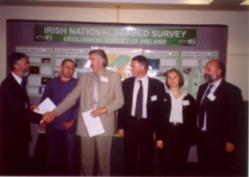
Agreement for the Fishing Industry Signed at Dublin Castle
Yet another milestone in the National Seabed Survey was reached in November 2002 when news of a strategic partnership emerged in Dublin Castle during the National Seabed Survey Seminar. The announcement of an agreement between the Geological Survey of Ireland (GSI), Barry Electronics Ltd., and BIM represents a significant step towards increasing efficiencies in the fishing industry. The agreement involves the distribution of bathymetric data (water depth) to Irish fishermen for use on electronic chart plotting systems.
 |
The National Seabed Survey has to date resulted in the survey of more than 420,000 sq kms in areas of water depth 200-4,500m. So far a number of paper maps covering 2° by 1° at a scale of 1:250,000 have been purchased by deep water fishing vessels. The maps depict the seabed contours as coloured bands and are complimented by shaded relief charts that provide a 3D 'picture' of the seabed, highlighting areas of interest. Multibeam 'backscatter' (echo strength) maps are also available to provide a measure of the seabed hardness. The signing of this agreement will take usage of the data from the National Seabed Survey to a more effective level. Barry Electronics Ltd will convert the electronic data for use on a specialised PC plotting system, which will display the electronic data on one screen in 2D showing seabed contour lines and also on a second screen showing the seabed in a visual 3D format for the Irish fishing industry. This will give Irish fishermen a unique opportunity to have at their disposal all the bottom information in 3D format for the entire continental shelf on an on-board electronic plotting system. This data can be utilised by fishermen to overlay their fishing tracks and catch information onto these 3D bottom charts. This will improve the efficiency of fishing vessels and minimise damage and lost trawls. The benefits will therefore be reduced time loss and increased catch capability. |
BIM and GSI anticipate that the agreement will lead to the development of a sophisticated plotting system that will not only assist Irish fishermen identify new grounds and reduce gear damage in "high-risk" areas but also allow avoidance of highly sensitive marine ecosystems, to minimise environmental impact on the seabed.
Surveying in Zone 2 (50-200m water depth) began in August using the Marine Institute's vessel the "Celtic Voyager," in Donegal Bay. Processing of this data will be done in due course. One interesting feature from the survey is an area known to local fishermen as "The Bank." This was shown in 3D format during one of the National Seabed Seminar presentations at Dublin Castle. Surveying will continue in Zone 2 in April 03 with the Marine Institute's new research vessel the "Celtic Explorer."
This agreement complements another joint GSI/BIM project funded by the NDP which is already well underway. This project, also part of the National Seabed Survey, is due to deliver seabed classification maps, useful in the determination of fish habitats, for specific interesting pilot areas.