Irish National Seabed Survey Data Access
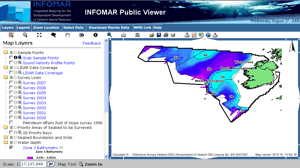
Coverage Charts to Dec 2005 can be viewed here. Online access to our data is now available here.
By now, as more and more individuals and organisations are becoming aware of the vast dataset associated with the INSS, GSI, as custodians of the data, are receiving substantial amounts of queries concerning usage of the data. In an attempt to try and improve our response time to data requests we have now decided on a system to track data requests and which makes it more efficient for us to handle and process them. Below is a one page data access request form which potential users must complete in order to provide us with some basic information about requirements, deliverables etc.
An incomplete listing of academic research projects that make use of INSS data is available here.
|
|
|
To view the data access form please click here: (pdf version, 62kb).
Forms should be printed off and faxed or posted to Charise McKeon, Marine Section, Geological Survey of Ireland, Beggars Bush, Haddington Road, Dublin 4. Fax ++353 1 678 2579. Alternatively, the form can be e-mailed to interested parties by requesting it from Charise.
| PDF Format: To view, download or print this document you will need the Adobe Acrobat Reader plug-in installed on your computer. You may download the reader by clicking on the Get Acrobat Reader image. |