Donegal Bay Survey
- Zone 2 Data Acquisition Commences
| On the nineteenth of August 2002 the Marine Institute vessel, the Celtic Voyager, mobilised in Galway Harbour in preparation for the commencement of Zone 2 (200-50m contour) data acquisition in the National Seabed Survey. Following on from the preparatory survey in Galway Bay in August 2001 and a further trial run in early August this year, the formal Zone 2 Survey could now begin in earnest. | 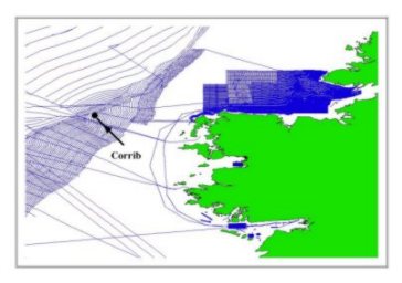 |
The Marine Institute has been contracted by G.S.I. to carry out the Zone 2 Survey. G.S.I. has been in a position to advise on all aspects of the survey following on from our experiences in the Zone 3 Survey. This co-operation is in keeping with the government's stated aim of improving and spreading the state's marine science expertise. On October 20 the 2002 surveying year formally came to a close when the Voyager returned to port. The image opposite shows the coverage in Donegal Bay, Clew Bay and Galway Bay during 2002.
 |
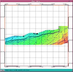 |
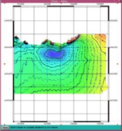
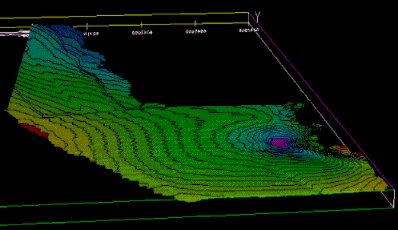
The two images above represent contours from the east (left) and west of the survey area. Several interesting features have already been preliminarily identified. The data needs to be processed fully before confirmations can be issued.
| The images on the right are 3D representations of parts of the area being surveyed in Donegal bay. The image on left is taken from just inside the 200m contour and the one on the right is from around St. John's Point. | 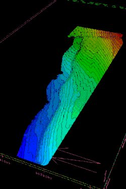 |
 |