Granuaile the latest vessel in the National Seabed Survey
|
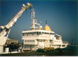
On October 1st the Commissioners of Irish Lights Vessel, Granuaile, became the latest vessel to operate within the National Seabed Survey. One of the original objectives of the survey was to spread marine surveying expertise as far as possible across various Irish organisations and institutions. This is just one example of how GSI has endeavoured to achieve this objective. |
| GSI and the Commissioners of Irish Lights (CIL) have long had a working relationship but the National Seabed Survey has truly cemented this relationship. This latest initiative whereby Granuaile has started data acquistion for GSI will almost certainly lead to continued co-operation into the future. |
 |
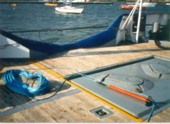 |
Granuaile's role is not as a survey vessel so she needed to be fitted out so as to be able to handle the task. GSI provided a lot of equipment and the necessary expertise to do so. CIL assisted in providing other equipment and by ensuring that the transition to surveying capability was a painless one. |
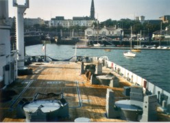
| At first Granuaile set off for the distant Rockall Bank to complete a section there of under 200m water depth but she was forced back towards the coast due to inclement weather conditions. An alternative survey area had been determined in advance (since the weather at this time of year is always likely to be adverse) so she came back into the Irish Sea where she is surveyed between Carlingford and Drogheda. She demobilised on Monday 11th October. |
 |