Annual National Seabed
Survey Seminars
Seminar 2002 -
see below
Seminar
2001
Seminar 2000
Annual National Seabed Seminar 2002
|
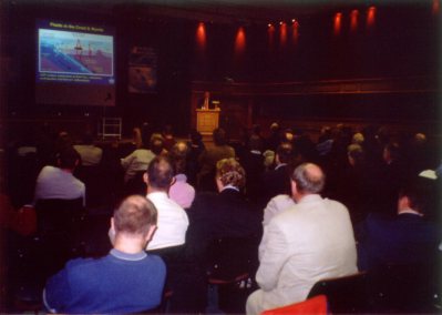
The fourth Annual National Seabed Survey Seminar - 2002 - took place in Dublin Castle on Thursday November 7th. It was an all day affair attended by upwards of 100 delegates, with approximately 14 presentations drawn from the many different elements of the National Seabed Survey. This year it formed part of the Marine Institute's 10-year anniversary conference which took place over three days from 5th-7th November. The seminar was addressed by Mr. Dermot Ahern, TD., Minister for Communications, Marine and Natural Resources.
|
 |
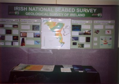
The programme for the 2002 seminar is detailed below. To order a free copy of a CD-rom copy of the presentations please contact Enda Gallagher (by e-mail) or telephone at ++353 1 6782834. Below also is a review of some of the issues that arose at the public forum at the end of the seminar. GSI operated a stand at the conference at which samples of maps and products were available for perusal.
Programme
|
Dr. Peadar McArdle - GSI "Welcome!" |
| Don
Finlayson - GOTECH "Mission Accomplished! - the Zone 3 Final Report" |
| Therese
Shryane - GSI "Zone 2 Data Acquisition - Galway Bay" |
| Margaret
Wilson & Michael Cunningham
- Marine Institute "Zone 2 Data Acquisition - Donegal Bay" |
| Dara
Hayes - Rovtec Systems "Lessons learnt from a small survey team" |
| Archie
Donovan - GSI "The IT Structure that supports the Survey - a 3 terrabyte data warehouse!" |
|
David
Falvey - BGS |
| Rhys
Barker - Tenix LADS Corporation "The Laser Airborne Survey of Clew Bay, July 2002" |
| Tom
Davitt - PGW "High Resolution Magnetics and Gravity Data" |
| Xavier
Monteys - GSI "Seabed Classification: a strategic partnership with BIM and the Fisheries Industry" |
| Glenn
Nolan
- Marine Institute "Temperature profile measurements from the Rockall Trough" |
| Eibhlin
Doyle - GSI "The Ground-truthing Programme - Seabed sampling and Seabed Classification" |
| Pat
Shannon - UCD "Geology of the Seabed: Deep Seismics - the Refraction Seismic Survey in the Hatton Basin" |
| Mick
Mackay - Coastal Resources Centre "Cetaceans and Seabirds in Waters over the Hatton-Rockall Region" |
| Mick
Geoghegan - GSI "The 2002 Survey Season - A Review and some Results" |
| Public Forum and Panel Discussion. |
Forum Review
 |
In opening the discussion, P. McArdle, GSI (Chair) noted the growing links between scientists and institutes involved in the work of the National Seabed Survey. The Seabed Technical Advisory Committee (STAC) had suggested that there is a need for a formal network for those involved in the seabed work. He said that feedback on this idea would be very welcome. |
In addition P. McArdle reminded participants that the National Seabed Survey was moving from a phase dominated by data acquisition to one where added-value projects would be more prominent. He invited (as done on previous occasions) any person, company or institute to contact GSI with ideas on adding value to data derived from the National Seabed Survey.
At an earlier session M. Orren had emphasised the importance of future sustained investment in data management in order to ensure that all data acquired during the National Seabed Survey will remain accessible in the future.
In response to a query from J. Collins about Clew Bay data, S. Cullen stated that contact had been established with the UK hydrographic authorities and that relevant data would be provided to them in order that shipping charts, for Irish waters, can be updated.
M. Geoghegan, in replying to Liz Sides (Heritage Council), explained the philosophy beneath the ground-truthing programme and stated that its primary purpose was to assist in the interpretation of seabed classification data. It was not intended to form the basis for a comprehensive biological sampling programme. He further said that Aquafact Ltd. had volunteered to undertake biological analysis of collected samples free of charge.
The delegate from NGU referred to its experience in using seabed sediments as time series for the tracking of pollutants past and present and urged that GSI consider similar work. M. Geoghegan noted that the geochemical analyses of an unspecified nature were already planned and that the NGU experience would be taken into account in determining the final programme.
Mr. John Breslin (Seabed Surveys) stated that there was an opportunity for fishing and survey vessels in the Celtic Sea to undertake seabed sampling in periods when other activities were not being undertaken. M. Geoghegan reiterated the GSI invitation for owners of such vessels to submit proposals to GSI
In response to Michael Bricks (GNF), M. Geoghegan stated that more information beyond bathymetry alone could be derived from laser data and this was an area for further development.
Prof. Pat Shannon (UCD) stated that much of the seabed data could support either exploitation or conservation activities and he wondered how that dilemma could be resolved. P. Mc Ardle responded that it was likely that both types of activities would continue in parallel with each other and that a balance between the two must be sought (rather that choosing one over the other). He argued that initiatives like the National Seabed Survey provide results that inform decision-makers, but that the scientists concerned are not themselves the decision-makers in this regard.
Shane Rooney (Waterborne Geophysics) congratulated the Marine Institute on its survey of stakeholder needs in Zone 1 (0-50 metres water depth). He felt this was very important in advance of data acquisition.
Colin Brown (UCG) argued that there must be an integrated approach to ocean management and that government should hear views on this from the scientific community. He considered that, now that the National Seabed Survey is moving beyond data acquisition, its STAC could be transformed into a more broadly based group that could adopt this wider agenda. In response it was stated that GSI would take account of these views.
Liz Sides argued that two new legal initiatives (the extension of EIAs to the offshore economic zone and the implementation in 2003 of Strategic Environmental Assessment involving large ocean areas) would be influential in developing integrated oceanic management. She further argued that the development of such an integrated policy approach would require a bottom-up approach and she considered that GSI would be the appropriate organisation to make this case. GSI stated these views would be carefully considered.
The NGU delegate reported that the laser technology was used in Norway to map and monitor the offshore kelp forest and he suggested that this be considered also for offshore Ireland. M. Geoghegan agreed with this approach.
Pat. Shannon wondered what data gaps might be identified in a few years time and how they might be addressed. D. Inamdar emphasised that the work to date was simply a reconnaissance survey and that there were many aspects still in need of study. M. Wilson (Marine Institute) agreed and gave further examples. P. McArdle stated that the National Seabed Survey was simply the first step in studying our seabed and that it was the task of GSI to ensure that adequate funding is secured in the future to sustain the seabed work. M. Geoghegan stated that the future strategic plan for seabed studies is outlined in the GSI publication "Maximising Value from the National Seabed Survey".
In closing the Open Forum, P. McArdle thanked presenters and participants for their contributions. He reiterated his pleasure that this year's seabed seminar had been part of the Marine Institute's Tenth Anniversary Conference. He thanked the Marine Institute for its support for the National Seabed Survey and congratulated it on its decade of achievement.