Brief Overview of INFOMAR/INSS
| Ireland's seabed area is a resource of major significance to the nation's future. INFOMAR/INSS, managed jointly by the Geological Survey of Ireland (GSI) and the Marine Institute in co-operation with other strategic partners, is a first attempt to truly understand this resource. |
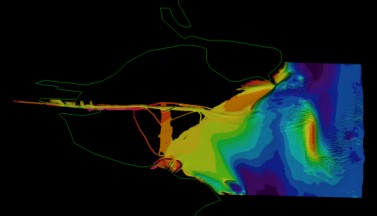 Dublin Bay Coverage |
INFOMAR/INSS
encompasses an area that is approximately ten times the size of Ireland's
land area and represents one of the largest seabed mapping projects undertaken
anywhere in the world. Maps that result from the survey are a pre-requisite
for the policy evolution, management and sustainable development of Ireland's
marine resources.
Objectives
of INFOMAR/INSS
INFOMAR/INSS is primarily about acquiring baseline information to promote and encourage research in marine science. Most of Ireland's seabed is unmapped and consequently represents a large untapped resource of potential benefit to many different sectors. In authorising this survey the government recognised that Ireland must maximise the commercial opportunities presented by its marine resources and plan measures to protect the marine environment in the most effective manner possible.
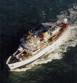
SV Bligh, the first survey vessel
INFOMAR/INSS
also represents an opportunity to build up national marine expertise and
to spread this expertise across government agencies, third level institutions
and a strengthened private sector.
Survey Components
- How is the survey carried out?
INFOMAR/INSS is primarily a multibeam sonar survey of an area of 525,000 sq. km in size. This acoustic technique is providing detailed bathymetry (water depth) data and knowledge of the nature of the seabed and its overlying sediment. Magnetic and gravity techniques are helping to evaluate the nature and structure of the deeper geology.
 Other
survey techniques are also being used to acquire additional primary datasets
including:
Other
survey techniques are also being used to acquire additional primary datasets
including:
- single beam echo sounder
- sub-bottom profiler (shallow seismic)
- water column measures of salinity, conductivity, temperature and speed of sound profiles
- seabed ground-truthing
- sidescan sonar
Ancillary
data is being collected on an opportunity basis and secondary projects
can be initiated researching a wide range of marine topics (for further
information see Ancillary Projects).
 Where
is the survey taking place?
Where
is the survey taking place?
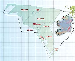
Ireland's territorial seabed reaches more than 600 miles out into the Atlantic Ocean to waters of more than 4,500 metres in depth. For full details see the large-scale Map. The territorial seabed has been split into three distinct areas or contours for surveying purposes:
- 0-50m contour (Zone 1)
- 50-200m contour (Zone 2)
- 200-4,500m contour (Zone 3)
The other primary area of work is the addition of value to the data via our extensive data-processing programme in-house in GSI.
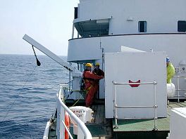
On-board Quality Control
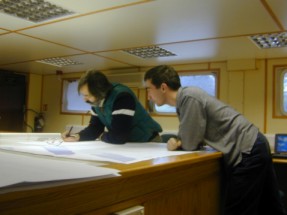 |
Each survey vessel has at least one GSI representative who acts in a Quality Control and Co-ordination role, and ensures that GSI objectives are met. The Captain of the vessel naturally is in charge of all vessel activities with a Party Chief as his deputy. All personnel working on the vessels must have up to date and valid Medical and Survival/Safety Training Certificates (this includes ancillary scientists). In the 2001 Annual Seabed Survey Seminar a GSI rep recounted his experiences giving an in-depth perspective of the role. |
What information technology underpins the survey?
|
|
Much
consideration has been placed on IT requirements since the survey
is one which will originate vast amounts of data which will require
storage, verification, technical analysis and manipulation into
customer-friendly usage formats. Thus, the survey is underpinned
by a 6-terabyte-server architecture that gives GSI the functionality
to deal with different datasets. These are projected to grow exponentially
in line with 2-3 ships gathering data at a typically 150-day field
season (24hr day) each year for 5 years. |
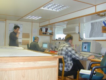
This overall I.T. architecture will ensure the provision of high quality interpreted data to customers.
For a review of previous years' activities click here.