|
Contributing to a
National Tide Gauge Network
| In
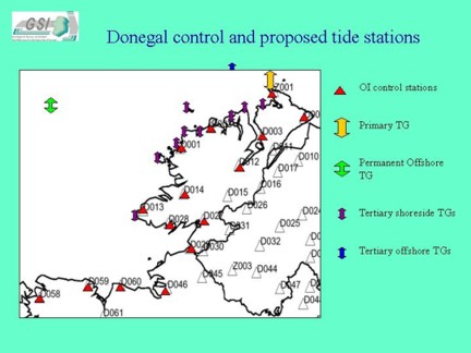
February 2004 GSI set about establishing a coastal network of control
points for the positioning of tide gauges around our coasts. The task
involves the identification of locations and their simultaneous benchmarking
for tide gauge installation. The results will provide accurate tidal
heights in the nearshore areas in which the ships will be surveying,
thereby providing a better and "cleaner" quality of data. |
 |
 |
GSI
realised the need for an accurate system of tide measurement as the
Celtic Explorer moved ever closer to the shore last year. We have
been using predicted tides in deeper waters and these measurements
were entirely satisfactory. However, closer to the shore tides are
more dependant on variables such as currents, wind speed etc so predicted
tides can be misleading. Hence, before 2004 surveying GSI will have
established a series of locations at which tide gauges can be installed
at short notice. |
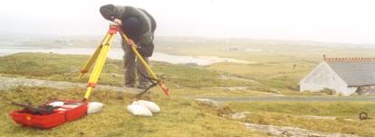
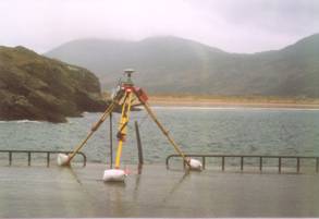
| The
use of the RTK system (inset) allows us to carry out accurate GPS
surveying such that the resulting network of control points will be
soundly based. The network will, in time, seamlessly and efficiently
feed into the forthcoming Irish Tidal Model. For further information
see the website www.irishtides.com |
 |
News
|