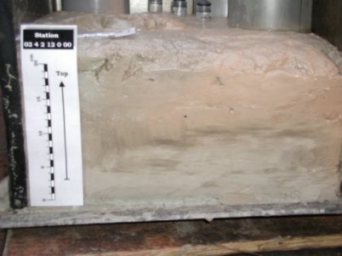
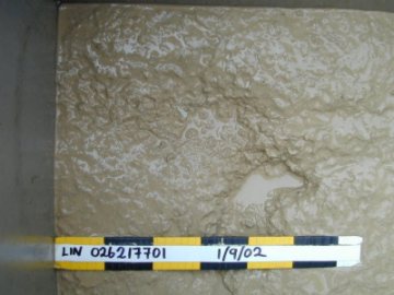
GSI's Ground-truthing (Sampling) Programme
|
The principal objective
of the programme is
to obtain a broad distribution of box core sediment samples for
use in seabed classification of multibeam data, and to form a baseline
geological, geochemical, geotechnical, and biological database of
the Irish seabed. Seabed samples are gathered from various locations,
photographed, described, and then sub-sampled for post-survey biological,
chemical, geotechnical, and sediment distribution laboratory analysis.
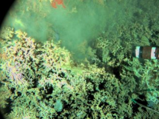
Video profiles are also taken On right is an image of deep-water
Atlantic coral (lophelia) taken from the Logachev. |
 |
|
Between May and July 2002 the GSI carried out the first portion of its Seabed Sampling Programme concentrating on sediments rather than rock cores.The programme includes seabed sampling, video runs and still photography and, in 2002, involved three separate contractors - the R/V Akademic Boris Petrov, the S/V Professor Logachev and the R.V. Ocean Seeker - with results being achieved from approximately 100 sites throughout the Zone 3 deepwater area. For further information on the 2002 programme click here. |
 |
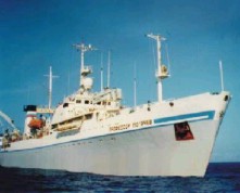
2003 Programme - Logachev Cruise - 31 August-14 September
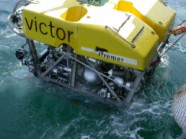 VICTOR ROV © IFREMER 2003 |
Last year's Groundtruthing Programme was deemed a successful one and shortly after its conclusion plans were in train for a further programme in 2003. This year three vessels - Explorer, Logachev and the Polarstern - have been used in further exploring the physical make-up of our seabed. |
 |
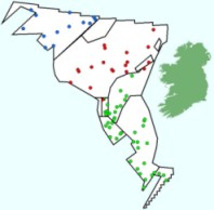
Following last year's successful use of the Logachev in the Groundtruthing Programme it was decided this year to use her again for a further programme. Investigation of the 2002 multibeam survey data identified the West Porcupine at the edge of the continental margin as a potentially interesting area in terms of its substrata and morphological features. The objective was therefore to carry out high resolution detail mapping on the area by use of side-scan sonar, sediment sampling and video lines. |
The trip was a successful one with 21 sites sampled and 5 video lines run amounting to between 10-15 hours of footage. The samples have been sent to the laboratory for analysis for geotechnical, geochemical and biological properties.
 |
The German research vessel, the Polarstern, was also used in this year's programme and a review of her cruise is posted here. Geochemical and biological analysis of last year's samples has been conducted and reports have been received which are now being studied. A presentation at the 2003 Annual Seabed Seminar will outline the results from last year's sampling programme. |