LADS (Laser Airborne
Depth Sounder) Survey
LADS
is an internationally accepted survey tool which is accurate to IHO standards.
With speeds of up to 65 sqkm/hour it is the fastest, most cost-effective
tool for accurate survey of the entire seabed area at depths of up to
70m in clear waters. It can be efficiently integrated with operations
of various survey ships.
 |
|
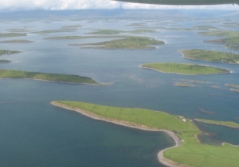
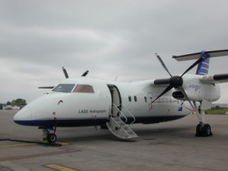
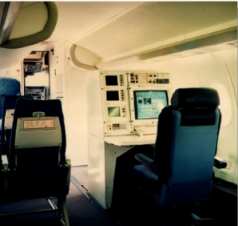
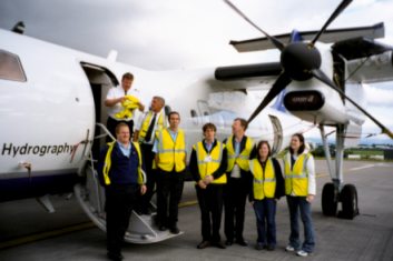
| Tenix had carried out the 2002 survey of Clew Bay over the weekend of the 22nd June. It had been a pilot study to see how appropriate Lidar technology was for Irish inshore waters since variables such as turbidity can cause difficulties for the systems. The evaluation of the pilot study, carried out initially in Australia, and then in GSI offices focused on survey processes, efficiency of data collection and data processing, system flexibility, survey coverage and survey accuracy. The LADS system uses a laser system mounted inside a fixed wing aircraft to measure the depth of water. Good weather and clear waters are required for best results. | 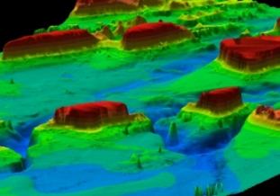 |
The Survey was a resounding success with the data being delivered of the highest quality so it was decided to advertise for a follow-up survey in 2003. GSI wished to extend the survey area within Clew Bay but contacted Mayo County Council to discuss the possibility of co-operation. Mayo CC were happy to co-operate providing the survey area could be extended to include Newport Bay since such a survey would assist the Council in its plans to provide a framework for a hydrodynamic model for the Bay. GSI was able to agree new parameters for the study area with Tenix and the appropriate contract was drawn up. As the survey preparatory work was being initiated Moyvalley Resources LTD, a community development organisation based in Ballina. approached us about the possibility of surveying a portion of Killala Bay and this too was ultimately included in the Survey area. Post-survey processing was completed in Tenix offices in Australia and the formal handover of the final report took place at the Oceanology 04 conference in London in March 2004.
 |
 |
 |