Annual National Seabed
Survey Seminar: 2000
Annual National Seabed Seminar 2000
Introduction
Agenda of Presentations
Session 1 Discussion
Session 2 Discussion
Session 3 Discussion
Open Forum
|
Over
90 representatives involved in the Irish marine offshore environment
attended the "National Seabed Seminar, 2000" held at the offices
of the G.S.I. on Friday 17th November. Representatives from the
many different marine sectors attended the all day seminar. The
programme was both comprehensive and wide-ranging with 15 speakers
representing the various sectors who would acquire a direct benefit
from the National Seabed Survey. |
 |
 |
On display in the entrance area there were numerous Seabed Posters and some initial bathymetric maps from areas surveyed during the 2000 acquisition season. Organisations that provided posters for display included UCD, TCD, the Irish Whale and Dolphin Group (IWDG) and the Coastal Resources Centre (CRC) attached to UCC. In addition, computer demos of the GSI Seabed & the Eumarsin websites were on display and available for all to access. This exhibition area gave the opportunity to the various workers on Ancillary and Strategic Research projects to display posters and discuss their development with other interested parties. |
The Agenda of presentations for the day was as follows:
| Deepak
Inamdar - GSI "GSI's role in the Seabed Survey. Background and objectives. Ireland's contribution to EUMARSIN." |
| Garret
Duffy - GSI "Technical report: implementation of survey, progress and results" |
| Noel
Hanley - GOTECH "The cut and thrust of a seabed survey. What it entails - the routine, the data, the difficulties and the expectations" |
| Dara
Hayes - Rovtec Systems "Data acquisition - a practical experience" |
| Ronan
Cosgrave - BIM "Benefits of the Seabed Survey to the Fishing Industry" |
| Evelyn
Murphy - Met Eireann "The Seabed Survey and Meteorology - how Met Eireann avails of the survey weather data" |
| John
O'Sullivan - Marine Institute "Ancillary Projects within the Seabed Survey" |
| Mick
Mackey & Oliver O'Cadhla - Coastal Resources Centre "Cetaceans and seabirds at sea off the west coast of Ireland" |
| Dave
Wall - Irish Whale & Dolphin Group "Exploratory cetacean surveys off the Irish coast" |
| Dr.
Anthony Grehan - Martin Ryan Institute "The Seabed Survey - an important first step in the development of an integrated ocean management strategy" |
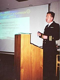
| Lt
Cdr. Mark Mellett "Achieving a defence policy-strategy match using naval delivered quality services" |
| Ray
Keary - LADS "Laser Airborne Depth Sounding" |
| Dr
Andy Wheeler - CRC & UCD "Seabed Survey Strategic Projects: south coast geological and bathymetric mapping" |
| Barry
Long - GSI "The Ocean Drilling Program - Ireland's opportunities" |
Session 1 - Questions and issues arising
The first session of the day focused mainly on GSI's progress during the 2000 surveying season. Speakers included representatives from GSI (including GSI reps on the vessels), GOTECH (the surveying company). The speakers presented the following;
- Fundamentals and objectives of the project
- Progress to date
- Problems and challenges encountered and their solutions, and
- Actual data examples and maps
Most of the material presented can be found spread appropriately around in this website.
| The
importance of taking Sound Velocity (SVP) measurements to correct
the Multibeam data was stressed, so why was it that the measurements
are not taken more than 2-3 times a day? GSI -It is generally not required to take that many SVP measurements in deep water systems, especially as in addition to the SVP dips the ship is acquiring constant real time temperature and conductivity measurements from a hull mounted sensor. |
|
Oscar Merne - National Parks & Wildlife Service noted that he had
reservations about long lining particularly with the problem of Bi
catch. There was concern that Shearwater migrations in Irish waters
along the shelf break could be adversely affected by this fishing
technique. BIM stressed the importance of having reliable observer reports. The Norwegians have put a lot of development into this particular problem and it is their particular system that BIM are trailing. To date there do not seem to be any problems. |
| Andy
Wheeler - CRC. Commented that he was impressed by the level of processing
and the quality of the Seabed Survey's multibeam results. GSI - the processing of the data was very minor and no post processing of the data had occurred yet. They too had been very impressed with the quality of the data. |
| Finbar Moore -Duchas.
Inquired if any wrecks had been identified yet? GSI replied that none have been identified yet, the resolution of the data in deep water is such that wrecks could not be resolved, however when the survey begins to work in shallower waters there is potential for wreck identification and mapping. The best techniques for wreck identification however are considered to be side scan sonar and magnetics. |
| Geoffrey
O'Sullivan - M.I. Commented that the SVP data has a lot of potential
uses. Would that data be made available for researchers? GSI - access would be made available. |
| Ray
Keary - LADS. Was disappointed that GSI had not shown any data examples
from the Siren. While he was QC rep on board the Siren he had seen
some excellent data acquired east of the Rockall. GSI - there had been some very interesting results back from the Siren but due to the tight agenda there had not been sufficient time that day to present some of these. |
| Fred
Norman - Zirconsalt. Asked about the estimated running costs for 2
vessels? GOTECH replied that a standard rate would be around £20,000 to £23,000 per day per vessel. |
| Joe
Maddock - Irish Fisherman's Association. Commented that there is very
little published information on tidal streams and currents along the
West Coast. There is evidence to show that there are much stronger
currents off the shelf. GSI - In the shallower waters, where they plan to survey next year tidal gauges would have to be deployed. MI has commissioned a study From University Galway to produce a prediction model on CD. It is hoped that this will be completed by the end of December 2000. |
| The
question was asked at what resolution /scale would the GSI maps be
produced? GSI - the preliminary maps would be at the scale of 1:250,000 km, 2° x 1° map sheets. In shallower waters with the greater resolution of data more detailed maps could be achieved. The plan to store the data digitally will also give greater flexibility in mapping at different scales. |
Session 2 - Questions and issues arising
The second session focused on talks that were of a more ancillary nature to the main Seabed Survey, with speakers from various partner or associate organisations including the Marine Institute, the Coastal Resources Centre (C.R.C) and the Martin Ryan Institute.
John O'Sullivan of the Marine Institute presented a plan and appeal for Ancillary projects; "By identifying suitable ancillary projects, the Marine Institute aims to increase knowledge of our vast marine resource by maximising ship-time & resources during the Seabed Survey without compromising its strategic aim."
Dr. Anthony Grehan, Martin Ryan Institute, Galway spoke about the "The Seabed Survey -an important first step in the development of an integrated ocean management strategy." He outlined the proposal to establish an "Irish Marine Task force" to deal with integrated ocean management. He called for interested parties to approach him for further details. Potential members in the Task Force should include relevant sectors working in the Irish Offshore environment e.g. academia, MI, GSI, PAD, Navy, Irish Lights etc.
| Noel
Hanley - GOTECH. Asked if the Atlantic Frontiers Environmental Network
(AFEN), TOBI Project was considered to be good value for money? Anthony Grehan replied that the whole project had cost £2.8m and that the TOBI work was only part of the total work program, which had also included sampling, box cores, multicores, and off bottom video system. All of which had been considered good value. There however is a scientific need for an Irish owned marine video system, which could potentially belong to a National Pool of Marine Equipment. |
| The
Marine Institute were asked to comment on the status of Ancillary
projects, which were submitted at the Athlone, Seabed Survey Seminar
in 1999. Geoffrey O'Sulliian replied that groups who submitted proposals should be contacted within the short term. He also advised that due to recent changes in personnel in the MI it might well be worth contacting the MI directly again regarding Ancillary Projects. |
| The comment was made that the Fishing Industry has long known about the existence of deep sea, cold water corals. In Norwegian waters the state has created Marine protected areas where fishing is restricted and only long line fishing is permitted. |
Session 3 - Questions and issues arising
The final session of the Seminar focused on a Navy presentation on "defense policy strategy" and other geological and geophysical work relating to the National Seabed Survey, with presentations from LADS, CRC & UCD and GSI.
Ray Keary representing Tenix LADS (Laser Airborne Depth Sounder) made a presentation on the applications of the LADS technique, which can be used to survey in waters depths less than 70 meters. The GSI plan to run a small, pilot bathymetric survey using the LADS technique in shallow water off the Southeast coast of Ireland in 2001 (this was later postponed until 2002). The advantages of the LADS technique are that being airborne the acquisition is more time and cost effective than normal mulitbeam sonar techniques for shallow water e.g. up to 65 sqkm/hour survey rate (possible sounding grids, 2 x 2 m, 3 x 3 m, 4 x 4 m, 5 x 5 m, 6 x 6 m.)
Andy Wheeler for CRC spoke on behalf of the "Seabed Survey Strategic Projects: South Coast Geological & Bathymetric Mapping," part of the Strategic Research Programme, a programme run in conjunction with UCC and NUI Dublin. The programmed was designed to fulfil the following objectives;
- Enhance national expertise and capabilities in multibeam sonar applications
- Utilise Celtic Voyager Sea time and the Marine Institute multibeam capacity
- Develop partnership between universities and GSI
- Generate an understanding of palaeo-estuarine dynamics
- Extend coverage of the Seabed Survey
Barry Long, GSI gave a short presentation on Irish involvement in the Ocean Drilling program. Ireland, through GSI together with MI and Enterprise Ireland, indirectly became a member of ODP in 2000 by joining the European Science Foundation Consortium for Ocean Drilling (ECOD). The ODP is an international and long running program and is distinct from the National Seabed Survey, however the data and results are interlinked. The aims of the ODP are to better the understanding of tectonic processes that shape oceans and continents, including erosion of continents and climate change. As a member of ECOD Ireland is now able to submit drilling proposals in Irish waters and able to send Irish researchers on drilling programs. He requested interested researchers to submit formal submissions for the next proposal deadline, 15th MARCH 2001. One proposal in Irish waters is currently active: "Carbonate mounds, Porcupine basin." One new Irish proposal being assessed by ODP: "Grenville front's location, Rockall High." Two informal draft proposals have also been received by the GSI. General ODP information sheets with contact details were also distributed at the Seminar to potentially interested parties. For further information see ODP.
| Peter Croker -
PAD. Asked why the GSI had decided to do the LADS pilot survey off
the SE coast in the Irish Sea?
GSI - are planning to focus in on that area, because they had received a lot of customer interest in this particular region. Plus it was an area where GSI has a significant amount of other data to compliment the LADS data. |
| Finbarr
Moore - Duchas. Asked if any archeological sites had been identified
by the Strategic Projects' work? Andy Wheeler, CRC replied that no archaeological finds or wrecks have been identified during the Strategic Projects program. |
| Chris
Bean - UCD. Asked if the LADS technique is sensitive to sea roughness
and rugosity? Ray Keary replied that the technique is affected by sea roughness, but it can be adjusted for as a video/photographic record is also recorded during LADS acquisition on the aircraft so corrections can be made. It is however advisable to acquire data during the best weather window. |
| "What
are the larger research community doing to get into the ODP network"?
The GSI can communicate with various interested researchers in relation to upcoming opportunities, developments and deadlines. If a proposal in Irish waters is accepted the GSI is entitled to put 2 technical staff working on the drilling programme |
| Andrew
Cooper - University of Ulster. Asked if the LADS Pilot study includes
any of the area already surveyed by the university "Strategic Projects"?
GSI replied that the LADS pilot study does not cover the same area of interest. |
| Oliver
Tully - TCD Asked if proposals for Ancillary projects would still
be invited? The MI announced that they would be managing the Ancillary Seabed Survey Projects from 2001 onwards. The MI plan to make the "MI Research Measures Programme" announcements in Galway on 5th December and in Dublin on 7th December. MI would consider proposals and apologised to those who had submitted proposals during 2000 and at Athlone 1999 who had not received notifications or acceptances for submitted projects. Unfortunately the MI had experienced delays in arranging the "Marine Research Measures Programme." |
| Evelyn
Murphy - Met Eireann. Asked if there was a plan to put all the digital
bathymetric data into one regional dataset? GSI replied that all the data would be available in digital format and that they would probably produce one large-scale regional digital map if there were a significant customer interest to produce one. |
|
Michael Philcox - Asked how much
the data would cost for research institutes? GSI replied that cost scenarios, data access and licensing issues are still to be resolved. The plan will be to make data available to research institutes since the GSI want to encourage maximum usage of the data, however the GSI plan to recover some revenue from the sale of data and maps. Researchers are reminded that the closing date for European Marine Ecosystems projects for Irish Researchers is the 15th October 2001 under the current EU programme. |
| Pat
Shannon, UCD Asked when would the first lot of data be available?
GSI - they would hope to have data available for purchase in June 2001. |
| Joe Maddocks, Irish Fisherman's Association Congratulated the Navy on the charting of fishing activity. Knowing the level of foreign, fishing activity in the Irish offshore is particularly useful |
In the closing comments Peadar McArdle, Director GSI thanked all the speakers, chair, and organisers of the seminar for their contributions to a most successful day. The Seminar had provided a huge opportunity for those workers involved in the Marine Environment to see the progress to date of the National Seabed Survey. The forum had provided an opportunity to build upon the spirit shown to increase the knowledge and skills of the Irish maritime nation.