2003 Summary Review
This summary review concentrates on 2003 activity but if you wish to access more historical information please click on the appropriate heading:
| Zone
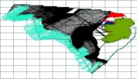
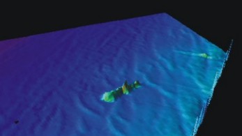
2 The 2003 surveying season concluded in November. It was a very successful season. All five scheduled legs of Zone 2 acquisition (50-200m contour area) have been completed by the Marine Institute's new vessel, the Celtic Explorer, in Donegal Bay. This represents more than 16,000 sq kms or 13.5% of the Zone 2 area survey. Killybegs proved to be an ideal port base for activities this year before she demobilised to Galway on 17 September. Zone 2 data acquisition will continue through 2005. Above image represents overall INSS coverage to November 2003. |
 |
| The Explorer is equipped to gather sea floor information utilising state-of-the-art hydrographic and geophysical equipment and is accurately positioned using Fugro StarFix DGPS, which in addition to providing decimetre-accurate positions, includes a sophisticated height correction; permitting the injection of the tidal component into the acoustic data sets. To accurately map the sea floor character and water depth, the vessel is equipped with a Kongsberg Simrad EM1002 multibeam echo sounder and a Kongsberg Simrad EA600 multi-frequency single beam echo sounder. Simultaneous profiles of the shallow sub sea floor geology are acquired using a pinger system. Whilst underway, continuous measurements of the Earth's gravity field are recorded on a LaCoste & Romberg SL Gravity meter, and a Geometrics G881 Magnetometer towfish is also towed aft of the vessel. | 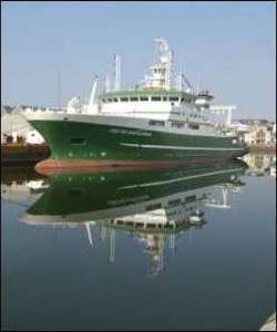 |
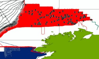
| Data processing and interpretation is carried out on board the vessel by a team of experienced hydrographic surveyors, geophysicists, data processors and CAD/GIS operators. At the end of each leg the shore teams are presented with a series of completed charts, data tapes and reports. Then the GSI in-house quality control mechanisms are called upon and further processing commences together with the value-added process. On right is a data example taken from the Explorer in August. |
|
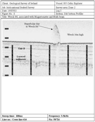
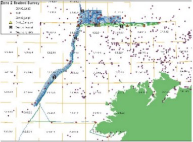
The north of Donegal survey area is dotted with UKHO-reported wreck locations and as many as 104 have so far been identified, including a few unidentified ones as well. The images below are from earlier survey legs this year. We are in discussions with the National Parks and Wildlife Service about building a more comprehensive database of our findings, using their expertise.
 |
 |
Zone 3 - Groundtruthing Programme
By the end of the fourth surveying season (2003) ten vessels and one airplane had been involved in carrying out the National Seabed Survey. 2003 saw the use of a further four vessels - the Celtic Explorer, the Commissioners of Irish Lights vessel the Granuaile, the British Antartic Survey's vessel the J. Clark Ross and the German research vessel, the Polarstern. The Polarstern was used to further extend 2002's highly successful ground-truthing programme and a profile of its cruise can be found here.
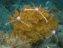
| Seabed sampling or Groundtruthing is important because the various features being imaged using the multibeam technique cannot be fully understood and interpreted without groundtruth data. The Logachev was again used this year for further work and has delivered excellent data from the West Porcupine at the edge of the continental margin. Seperately, samples from four locations were recovered as part of a taxonomic study of benthic species by the Martin Ryan Institute in NUI Galway. |
|
| Geological ground truthing for seabed classification based on backscatter data is the primary objective of the seabed sampling programme. Geochemical and biological analysis of the samples was conducted last year and this year's samples are currently being analysed. A presentation at the 2003 Annual Seabed Seminar will outline the results from last year's sampling programme. The Logachev was again used this year. So too was the Polarstern and also the Explorer. For a review of the GSI's Groundtruthing Programme please click here. |
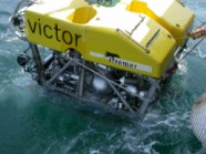 VICTOR ROV © IFREMER 2003 |
Also in Zone 3 the British Antartic Survey's vessel the J. Clark Ross was used to infill a triangular gap within the PAD deepwater area using their EM120 multibeam. The PAD - Petroleum Affairs Division - area was surveyed in 1996 to delineate the boundaries of Ireland's offshore area.
Zone 1
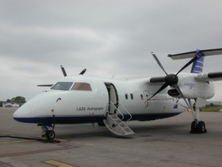
Following on from last year's highly successful Lidar survey in Clew Bay in the Zone 1 area it was decided to extend this survey further this year. So, an international tender process was carried out that saw Tenix LADS again successful and they commenced work Clew Bay, Newport Bay and Killala Bay in September.
 |
Results from last year's Survey which were initially processed in Australia by the contractors, the Tenix LADS Corporation and then QC-checked in GSI offices were found to be excellent. A formal handover of the data to the Westport Harbour Authority took place earlier this year and GSI has also given the data to the British Hydrographic Office so that a more than 100 year old navigation chart for the area can be updated. |
The Granuaile became the tenth vessel to join the National Seabed Survey fleet in October. She carried out surveying in Zone 1 between Clogher Head and Drogheda. For a summary of her cruise click here.