News
| 2004 | 2003 | 2002 | 2001 and Before |
- INSS Annual Seminar - 5 November
- Hydr04 Review - 2 - 4 November
- Announcement of Seabed Classification Workshop in GSI - 26 November
- Irish branch Hydrographic Society - 4 November
- INSS involved in MESH Project - September
- INSS Annual Seminar Announcement: - 7 September
- GSI issues Request for Expressions of Interest in licensing INSS data - 9 August
- Visit by Newfoundland Premier - 7 July
- New Seabed Classification Maps - July
- Recent Imagery from INSS - 4 July
- 2004 Conference Participation Review - 4 July
- Presentation to Master Mariners - 15 June
- Presentation to Moyvalley Resources Ltd Seminar - 10 June
- Marine Grid Initiative - May
- Annual Seminar to take place in Galway, 5 November - May
- Data Access - May
- Ministerial Function and INSS Scientific Forum - April 6
- International
Conferences for Ireland - April
-
GeoHAB, Galway 5-7 May
- Eurocean, Galway 10-13 May
- Hydr04, Galway 2-4 November
- Femme 05, Dublin April 2005
-
- Oceanology Conference Review - April
- ConCat Survey in Dublin Bay - April
- Contributing to a National Tide Gauge Network - March
- New Schools Visit Programme commences - March 12
- INSS on TV in February!
- INSS to exhibit at Oceanology 04 in March
- INSS at the RDS Young Scientists Exhibition
- INSS
2003 Summary Review
Announcement of Workshop in GSI
INSS's work on Seabed Classification is breaking new ground and various international organisations are now seeking to learn from the Irish experience. To this end GSI and Quester Tangent Corp. are hosting a workshop in Seabed Classification on 25th & 26th January 2005. The purpose of this workshop is both to provide a theoretical background and 'hands-on' experience to the QTC approach for seabed classification. Particular emphasis will be placed on data QA and production processing techniques. Techniques for post-processing, mapping and visualization will also be presented and widely discussed. Single-beam, multibeam and sidescan sonar data will be analysed, processed and the results exported during the tutorial. Full working versions of the software will be loaded onto participants PC's, experimentation with data processing is encouraged. Participants will be provided with data and 30-day licenses for data analysis following the workshop. For a full programme and registration details please contact Xavier Monteys (by e-mail) or ++353 1 678 2807
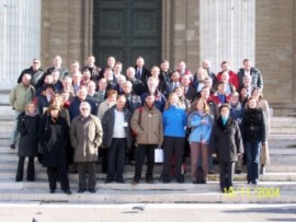
Irish branch Hydrographic Society Formed - 4 November
At the recent Hydr04 conference in Galway key members of the hydrographic surveying community in Ireland held the inaugural meeting of the Irish Branch of The Hydrographic Society. It was proposed that, in common with the Scottish Regions, the Irish Region would initially operate via the UK society. The Branch hopes "to serve the wider hydrographic community in Ireland by providing a neutral platform to air and discuss matters whose diversity and importance have increased greatly over recent years in tandem with the unprecedented and continuing expansion of the entire Irish maritime sector."
A meeting of the new Branch will take place in GSI offices on Wednesday 22nd December. For further information on the meeting and / or the new Branch please contact Sean Cullen, GSI
INSS involved in MESH Project - September
 |
INSS data are being used in an important EU project recently joined by the Marine Institute as Ireland's representative. This is a 3 year Interreg Mesh IIIB (Mapping European Seabed Habitats) habitat mapping project. MESH includes the collaboration of 14 private companies, public bodies and government institutions from five countries in North West Europe. |
| The aim is to develop standardised procedures for habitat mapping and to compile existing available data concerning habitat mapping in North West Europe into one GIS based database. Habitat forecast modelling based on available data is to be conducted in areas where data is sparse. The demand is now in place for the development of an internationally standardised framework on which to develop and collate habitat mapping data . The lack of international standards for these studies means the resulting data cannot readily be compared or aggregated and leads to an absence of regional, national and international perspectives on the seabed resource in spatial planning and decision-making. The MESH project will address this issue. More details can be found here. |  |
INSS and EuroSeismic - 19 November
 |
Deepak Inamdar and Archie Donovan from GSI represented INSS at a November meeting of EuroSeismic is Paris. EuroSeismic is the gateway to marine seismic and acoustic data in Europe.The meeting discussed the forthcoming launch of a website which will facilitate online access to European-wide seismic profile data. Further details can be obtained from Deepak Inamdar. |
Seminar 2004 Announcement - 7 October
SEMINAR 2004 WILL TAKE PLACE IN THE GALWAY BAY HOTEL ON 5 NOVEMBER 2004. The seminar will be run in the same venue and on the day after the conclusion of Hydr04, the Biennial Conference of the Hydrographic Society. GSI and the Hydrographic Society are actively co-operating in the joint promotion of both events. Please click here for further details on Hydr04.
The programme for the 2004 seminar is detailed here. GSI and MI will operate exhibit stands at the seminar at which samples of maps, products and seabed samples will be available for perusal. Organisations can also take space for their own exhibit stand at a cost of €200. There will also be a poster area which will detail academic, and other, projects that make use of INSS data. For further details please contact Enda Gallagher. On this occasion Kongsberg Maritime are kindly sponsoring lunch for all delegates.
Presentation to Master Mariners - 15 June
On 15 June 2004 Mick Geoghegan and Sean Cullen from GSI's INSS team presented to a gathering of the the Master Mariners of Ireland. The event which took place in the Stephen's Green Club in Dublin's city centre was attended by several current and retired Master Mariners from Dublin Port and other locations. The presentation took a standard format initially, outlining the work of the INSS and its importance to Irish society, but it then kicked off into a comprehensive review of data retrieved from two recent Dublin Bay (extending into the Irish Sea) surveys under the auspices of the INSS. The first took place in November when the Celtic Voyager surveyed in Dublin Port, followed by the March survey of Dublin and Dun Laoire ports by the ConCat catamaran. The presentation was received with great excitement particularly when new high resolution images from the surveys were displayed. For a low resolution representation of a couple of these images please click here.
Presentation to Moyvalley Resources Cycleau Seminar - 10 June
On 10 June 2004 Mick Geoghegan from GSI's INSS team presented to a seminar organised by Moyvalley Resources Ltd, a community development association based in Ballina, Co. Mayo. The seminar was a local information dessemination exercise on the European project entitled "Cycleau" for which Moyvalley is the Irish partner. This is an INTERREG IIIB Project: Best Practices in Environmental Management of Coastal / Estuary Catchments. One of its requirements was a bathymetric study of Killala Bay. This was completed last September by the Tenix LADS airborne survey of Clew Bay, extended into Killala Bay, under the auspices of the INSS. Mick presented the results from the Survey to the 30 or so invited guests, and showed some of the spectacular imagery that emerged from the survey. The seminar was followed by a discussion forum at which several farourable comments were made about the involvement of the INSS in the project.
For a low resolution representation of just a few of the images shown at the seminar please click here.
The Marine Grid is a collaboration between GSI, the Marine Institute and the four main Universities in Ireland funded by the HEA. In order for geologists and marine scientists to maximise their usage of this dataset it will require a new computing infrastructure i.e. Grid Computing (due to the enormous size of this data-set).
The Grid is an abstraction allowing transparent and pervasive access to distributed computing resources. Other desirable features of the Grid are that the access provided should be secure, dependable, efficient, and inexpensive, and enable a high degree of portability for computing applications. Today’s Internet can be regarded as a precursor to the Grid, but the Grid is much more than just a faster version of the Internet – a key feature of the Grid is that it provides access to a rich set of computing and information services. Many of these services are feasible only if network bandwidths increase significantly. Thus, improved network hardware and protocols, together with the provision of distributed services, are both important in establishing the Grid as an essential part the infrastructure of society in the 21st century. For further details on this far-sighted initiative please click here.
New Schools Visit Programme commences - March 12
GSI has recently launched
a schools initiative to try to encourage interest in the INSS from schoolchildren.
On 12 March a member of the INSS team - Tracy Walsh - visited Scoil Maelruain
in Tallaght, a school that educates more than a thousand children, to
give a presentation on the INSS and ocean currents.
Amy, one of Rachel Kearns' pupils was there to greet Tracy at the front
door to bring her to the classroom of about twenty five 11-12 year olds.
Tracy began her talk with a little information about the formation of
the oceans, then moved on to the INSS and her own job within this project.
This aroused great interest altogether. She finished with ocean currents
and their relationship to the Greenhouse Effect. The talk was met with
great approval by the children as it was specially prepared at their level
and with an emphasis on fun.
At the end of the very interactive
presentation the children presented Tracy with a card signed by each of
them individually. Much appreciated! Tracy
is happy to visit other schools to deliver similar presentations. Please
feel free to contact her on 01 678 2806 or Enda
Gallagher at 01 678 2834.
International Conferences for Ireland
In clear signals that the international profile of Irish marine science has dramatically increased over the last few years (not least because of the the exposure garnered from the INSS) recent announcements have indicated the arrival of several international conferences to Ireland, some particularly large and prestigious. (As this was posted early in 2004 as an earlier news item, an update of how some of these conferences actually went is posted here.)
GeoHAB
(Geological
Habitat Mapping Symposium) will be held in Galway
from 5-7 May. The GSI and the Marine Institute are co-sponsors of this
international conference which concentrates on marine geological and biological
habitat mapping. There will be a session dedicated to INSS together with
exhibit stands displaying some of the data. Registration and abstract
details are available here.
EurOCEAN
2004 will also be held in Galway in May (10-13). The Marine Institute,
in association with the EU Commission and the ESF-Marine Board, will host
this prestigious conference as an Irish EU Presidency Event. The Conference
will review marine R&D projects supported under the EU's 5th and 6th
Framework Programmes and will contribute to the European Marine Research
Agenda over the coming decade. The INSS will be devoted a special presentation
on the evening of the 11th May from 18.00 - 19.30 hrs. Further information
on this conference can be accessed here.
Hydr04 will take place in Galway from 2-4 November 2004 and Femme 05 will take place in Dublin in April 2005. Hydr04 is the 14th Biennial Conference of the International Federation of Hydrographic Societies. It is organised by the Hydrographic Society. Founded in 1972 and with headquarters at the University of East London this society is an international learned organisation maintaining five national branches, in Australasia, the Benelux, Denmark, the UK and US. The Society's principal aims include the promotion of the science of surveying over water and related disciplines as well as the fostering of recognised standards of education and training for those engaged, or intending to engage in hydrographic work. Details on this conference can be found here. As recognition of GSI's excellent relationship with the Hydrographic Society and the conference's organising committee we have decided to attach our own Annual Seminar onto the end of the conference - 5 November, at the same Galway Bay Hotel venue. This will offer many international delegates, in particular, the opportunity to stay over for an extra night in order to update themselves on the progress of the Irish National Seabed Survey. GSI and the Hydrographic Society are actively co-operating in the joint promotion of both events.
Femme '05 is the bi-annual Kongsberg Simrad forum for Multibeam echo sounder system users. The objective of their conferences is to maximize the real-life performance of Kongsberg Simrad Multibeams; in the context of the National Seabed Survey this objective is of utmost interest to GSI. This is the first time Kongsberg has brought this conference to Ireland, recognition indeed of the international awareness of the importance of Ireland's seabed survey.
Irish National Seabed Survey on TV in February!
 |
The INSS received some welcome TV publicity on Tuesday the 3rd of February when a four minute segment aired on RTE Network 2 at 7pm during the "Scope" science series. The segment was filmed in September for this series which is aimed at the youth market. The filming took place on board the Celtic Explorer in Rossaveal harbour. For further information on the filming click here. |
Irish National Seabed Survey will exhibit at Oceanology '04 in March
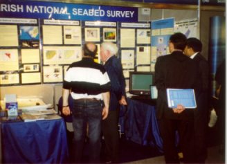
| From 16-19 March 2004 inclusive G.S.I. will exhibit the results of the INSS to date at a stand at Oceanology International's London conference (OI 2004, London). This is the leading international marine conference held every second year. It attracted 600 exhibitors and around 7000 attendees in 2002 and looks set to emulate these figures this year. G.S.I. had a stand at the 2002 conference and were happy with the interest levels displayed by the international audience at that time. However, with an additional two years data available this year we will be in a better position to attract an audience. |  |
For a review of our attendance at OI 2002 please click here. The conference venue is Excel, London and our stand number is 355. We will be jointly exhibiting with the Marine Institute who occupy the stand immediately beside us. Further details about the conference can be found here.
INSS at the RDS Young Scientists Exhibition
At the Marine Institute exhibit at the 2004 ESAT Young Scientists Exhibition held from 8-10 January in the RDS, GSI helped out via our attendance at the stand to demonstrate the INSS. In an example of excellent co-operation between the two organisations, GSI accepted the MI's generous invitation and were able to promote the INSS with the use of a lap-top computer and brochures. The lap-top display was primarily based on a 3d visualisation software package, Fledermaus, which facilitated a short "fly-through" of some of the features of the Irish seafloor. Displaying great mountain ranges and vast canyons, this fly-through was warmly welcomed by a mostly surprised, youthful audience, and the level of interest the INSS generated overall throughout the three day exhibition was hugely impressive.